Dedoctive grounds outputs in trusted evidence, provides full source-level provenance, and governs workflows with human-in-the-loop guardrails.
Email hello@collaboration-tools.com to request a free micro-pilot
Category: Knowledge Model-Driven Q&A
-
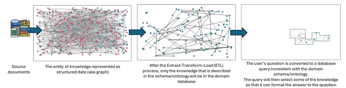
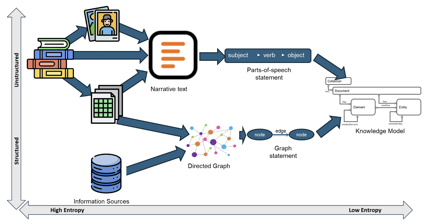
To truly understand how to fix modern AI queries, we must trace how data evolves from raw text to a final answer, and look at the catastrophic loss of information that occurs when we impose a domain ontology too early in the process.
-
While AI continues to evolve rapidly, developers and enterprises face a common challenge: maintaining control and transparency without sacrificing the power of generative agents. At Collaboration Tools, we are bridging this gap with a hybrid approach based on our unique Dedoctive technology.
-
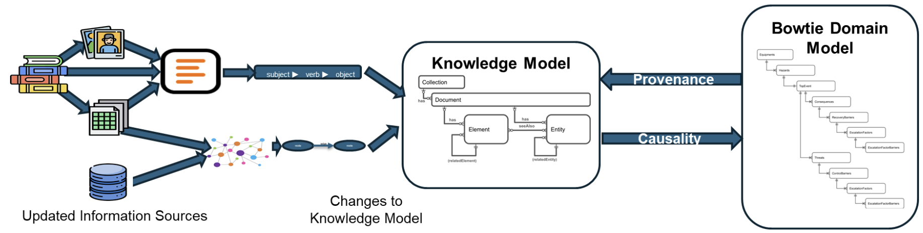
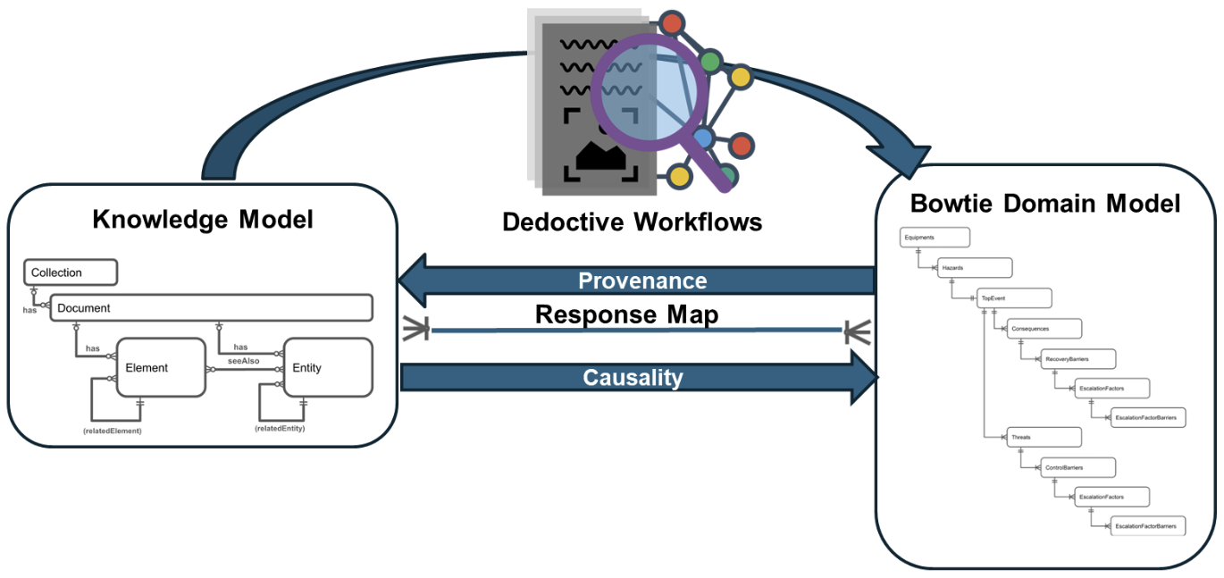
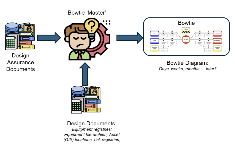
Think of traditional safety analysis like a paper map; it’s static, hard to read, and quickly becomes out of date. Dedoctive is like a live GPS system. It takes all the raw data (the roads), understands the connections (the routes), and updates in real-time as the situation on the ground changes, always showing you exactly…
-
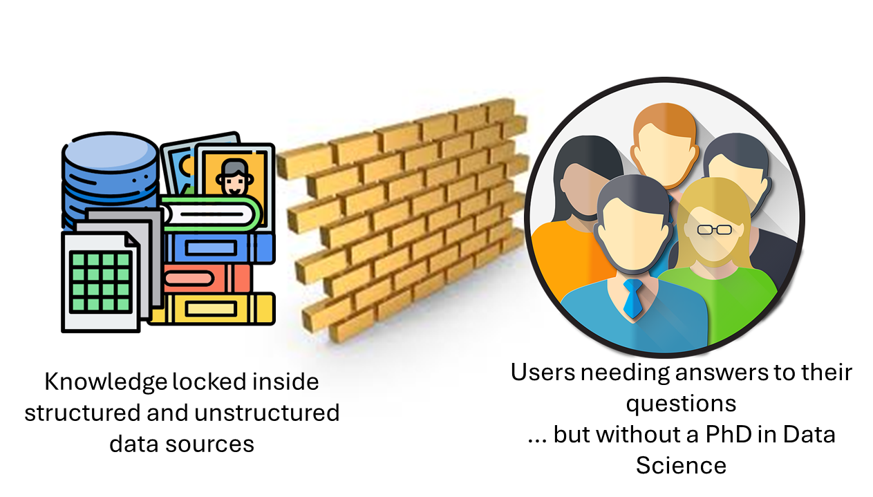
We’ve all been there—drowning in our own data, unsure how to even begin asking the right question. Until now, doing anything meaningful with that data usually meant brushing up on query languages, search syntax, or relying on dashboards someone else built. But it doesn’t have to be that way.